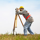
GEODESY
› Geodetic networks
› Geodetic photographs
› Tracing
CADASTRE
› Cadastral maps and registers
› Cadastral plans
› Agreements for the use of agricultural land under Art. 37c and Art. 37g of the Agricultural Land Use Act
DETAILED LAYOUT PLANS
› Regulatory plans
› Building plans
› Plot plans

DESIGNING
› Vertical planning projects
› Routing plans
› Deformation research projects
LiDAR and PHOTOGRAMMETRY
› Aerial laser scanning with RiEGL miniVUX-3UAV sensor
› Aerial photogrammetry
ABOUT US
“Geocadengineering” Ltd. is a company with many years of experience in offering and providing geodetic services to corporate and private clients.
The precision in the implementation of the projects, the attention and personal attitude towards the client, the high dynamics of the work process, as well as the highly qualified team of specialists make “Geocadengineering” Ltd. a reliable partner for your successful projects!
Our partners: